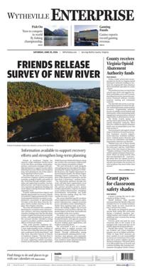

Friends release survey of New River

Friends of Southwest Virginia has released a survey of the New River.
Friends of Southwest Virginia has released a High-Definition Stream Survey of the New River, providing communities, partners, and resource managers with valuable information to support recovery efforts following Hurricane Helene and strengthen long-term planning for one of the region's most important natural assets.
The New River serves as a cornerstone of Southwest Virginia's outdoor recreation economy, ecological health, and quality of life. Stretching through multiple communities and supporting recreation, tourism, infrastructure, and natural resources, the river experienced significant flooding and storm impacts during Hurricane Helene in September 2024.
To better understand those impacts and identify opportunities for recovery, Friends of Southwest Virginia partnered with Trutta Environmental Solutions to conduct a comprehensive assessment of approximately 170 miles of the New River, from the Virginia-North Carolina state line to the Virginia-West Virginia state line.
The study documented river conditions, flood impacts, recreation assets, infrastructure concerns, and areas requiring future attention. Findings show that the New River remains a largely functional and sustainable system, with approximately 68 percent of the surveyed corridor classified as being in good to excellent condition despite the effects of Hurricane Helene.
"This study provides Southwest Virginia with something incredibly valuable, a clear understanding of the condition of the New River following Hurricane Helene and a roadmap for future investment," said Kim Davis, Executive Director of Friends of Southwest Virginia. "The New River is one of our region's most important natural assets, supporting outdoor recreation, tourism, local economies, and quality of life. While Hurricane Helene left impacts along the corridor, this assessment confirms that the river remains remarkably resilient."
"We were fortunate to work alongside outstanding partners throughout this effort, including the Virginia Department of Wildlife Resources, the Virginia Department of Environmental Quality, the Mount Rogers Planning District Commission, the New River Valley Regional Commission, and the New River Conservancy," continue Davis. "The information gathered through this study will help these organizations, local governments, state agencies, and community partners prioritize projects, pursue funding opportunities, improve recreation access, protect infrastructure, strengthen environmental stewardship, and guide future decision-making along the river corridor for years to come."
The survey identified specific locations where targeted action could improve safety, protect infrastructure, support recreation access, and address storm-related impacts. Rather than requiring large-scale restoration, the findings suggest that focused investments at key locations will have the greatest impact on the long-term health and accessibility of the river corridor.
The project also created a comprehensive geospatial database that can be used by local governments, state agencies, planners, and community partners to support future decision-making, grant applications, and resilience planning efforts.
The assessment is part of a broader regional effort to support recovery and strengthen resilience following Hurricane Helene. Through collaboration among local governments, planning district commissions, state agencies, and community partners, Southwest Virginia is building the tools needed to make informed decisions and prepare for future challenges.