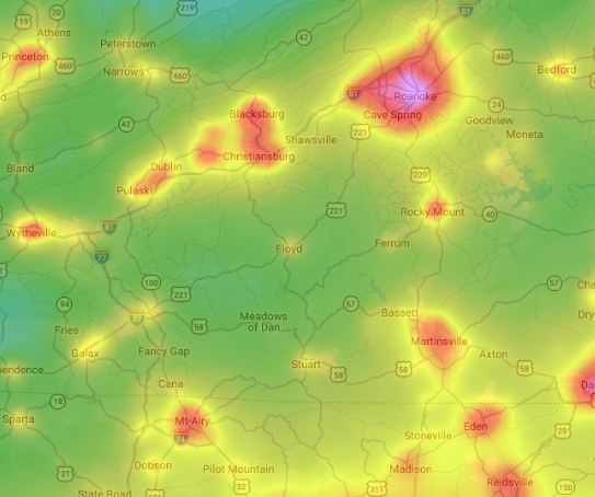
This map highlights the relatively dark skies of Floyd County. On the nine-level Bortle Dark Sky Scale, where Class 1 represents the darkest skies and Class 9 the brightest urban skies, Floyd County is approximately Class 3–4, compared with Class 5 in Blacksburg, Class 6 in Roanoke, and Class 8–9 in Richmond. Some of the darkest areas of West Virginia’s Monongahela National Forest reach Class 2, while remote ocean locations far from populated landmasses can offer Class 1 conditions, where the central region of the Milky Way can cast visible shadows.
Members of the Ashe Dark Sky Coalition, led by dark sky advocate and environmental consultant Cory Dalton and astronomy enthusiast John Boston, will present two evenings of astronomy viewing and education at Floyd EcoVillage on Friday and Saturday, Nov. 13 and 14, from 6 p.m. to midnight, weather permitting. Each evening is a separate event, and attendees are welcome to participate in one or both. The event is free and open to the public.
The cost of diesel is forcing the Smyth County School Board to examine its routes and look at ways to curb fuel use.
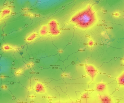
This map highlights the relatively dark skies of Floyd County. On the nine-level Bortle Dark Sky Scale, where Class 1 represents the darkest skies and Class 9 the brightest urban skies, Floyd County is approximately Class 3–4, compared with Class 5 in Blacksburg, Class 6 in Roanoke, and Class 8–9 in Richmond. Some of the darkest areas of West Virginia’s Monongahela National Forest reach Class 2, while remote ocean locations far from populated landmasses can offer Class 1 conditions, where the central region of the Milky Way can cast visible shadows.